The sand table is divided into simple sand table and permanent sand table. It is temporarily stacked on the site with sediment and war chess. The sequence is: prepare on the map, determine the horizontal scale and vertical scale of the sand table (usually the horizontal scale is smaller than the vertical scale), calculate the size of the sand table, stack the landform, set up ground objects and military conditions. The main method is to stack landforms. The method is to select low contour lines and relevant geomorphic feature points, transfer their positions from the topographic map to the sand surface, calculate the height of the tabs at the top, saddle, foot, etc. according to the vertical scale, and stack them against the topographic map. Generally, it is made of foamed plastic board or plywood, gypsum powder, paper pulp and other materials. The method is basically the same as that of stacking simple sand table, but for molding landform, it is necessary to enlarge the base map, release and nail contour boards, stack plastic fillers and paint the surface color.
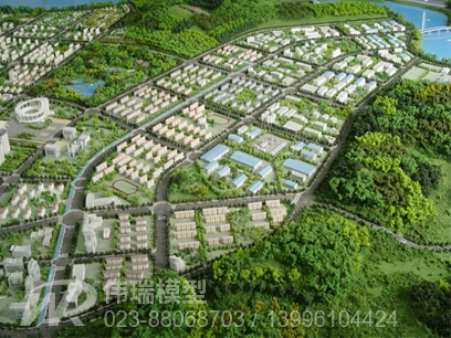
1. Terrain sand table:
The terrain model represents the terrain and geomorphic features in the form of micro entities, and reflects mountains, water bodies, roads and other objects in the model, mainly representing terrain data, so that people can understand macro things from a microscopic perspective. The terrain model has a wide range of applications, mainly in the following industries: government, transportation, water conservancy, electricity, public security command, land and resources, tourism, human resources, military, etc.
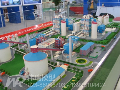
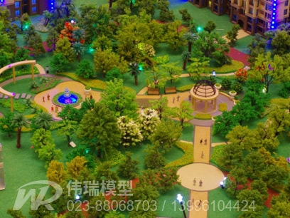
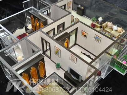
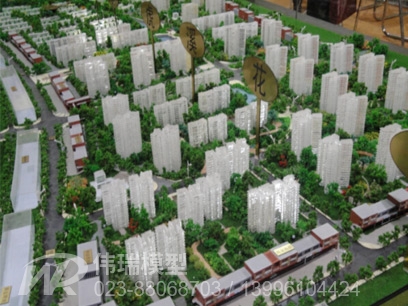
2. Construction sand table:
Building model It represents the architectural art in the form of miniature entity. Both the single modeling and the group combination are the true expression of the structure of architectural ideas, transforming the intention of the architect into a specific image.

3. Electronic sand table:
The electronic sand table can dynamically search the geographical information of each point in real time through the real 3D geographic information data and the use of advanced geographic information technology. Such as three-dimensional coordinates, height, slope, rivers, roads and various artificial works and facilities, long-term planning and other information. And it can conduct 3D single point flight, path flight, round point flight, engineering facility query, economic benefit analysis and other intelligent analysis on the computer in real time through the advanced 3D simulation function. It is applicable to the site selection of mobile communication, the planning and construction of large-scale water conservancy facilities and other units closely related to geography and terrain. Shown in the exhibition hall is the sand table of Tiananmen Square
Electronic sand table is divided into three-dimensional electronic sand table, acousto-optic sand table and multimedia touch sand table. It is composed of multimedia computer (touch screen all-in-one machine), logic controller, driver, stage lighting controller, touch remote controller (PDA handheld computer) and other equipment, and it cooperates with model sand table, large screen projection and multimedia display software to realize automatic, manual and remote control of model lighting and stage lighting actions, and uses voice, text Pictures, video images and other multimedia forms are used to synchronously display all kinds of relevant information in the model sand table to achieve an all-round interactive multimedia display effect.
Model sand table and application computer intelligent display control system in exhibition hall application is a high-tech and creative design. It can make the public understand the contents of the model sand table vividly, vividly, quickly and accurately, and can effectively achieve the purpose of showing to the public. It actually covers the needs of viewers: intelligent technologies such as voice introduction, touch intelligence, lighting effects, remote control, etc., making the exhibition hall full of vitality, intelligence, variety, convenient display and modification and other functions.
a. 3D interactive virtual building -- building model placed in computer
3D interactive virtual real estate is a pre-sale tool that can upgrade and replace building models and model houses. It uses the design drawings and material data provided by real estate developers to accurately simulate the proposed building 1:1 on the computer, with large scenes and local rendering, to create a shocking audio-visual effect and improve the performance of on-site sales. Customers can enter the virtual building in the sales department or website, just like playing games, to walk around and fly up and down in the virtual building, and can enter the desired room to view the decoration effect, as well as understand the surrounding environment, traffic location, development company strength, mortgage calculation amount, etc. The system can automatically generate 3D cartoons for broadcasting and TV advertising in the sales department.
b. Multimedia sand table
The multimedia sand table can stereoscopically display the mountains, rivers, topography and landforms in the region of the government or department at the same level, and reflect the departments of governments at all levels and various command elements in various forms. Computer multimedia control technology is adopted to make sound (commentary), light, image and subtitle display synchronously or asynchronously, which can be controlled by remote control, manual control, inductive control or multimedia control; Not only digital display, single point display, combined display, dynamic display, but also remote video monitoring display can be realized with only one telephone line. It is flexible, simple, easy to maintain and modify.